
Case study – 3d monitoring
Institution of Civil Engineers – Westminster, London
THE BRIEF:
To accurate monitor the ornate fibrous plaster ceilings in 11 principal rooms on an annual basis, research and establish a method of comparing the data.
METHODOLOGY:
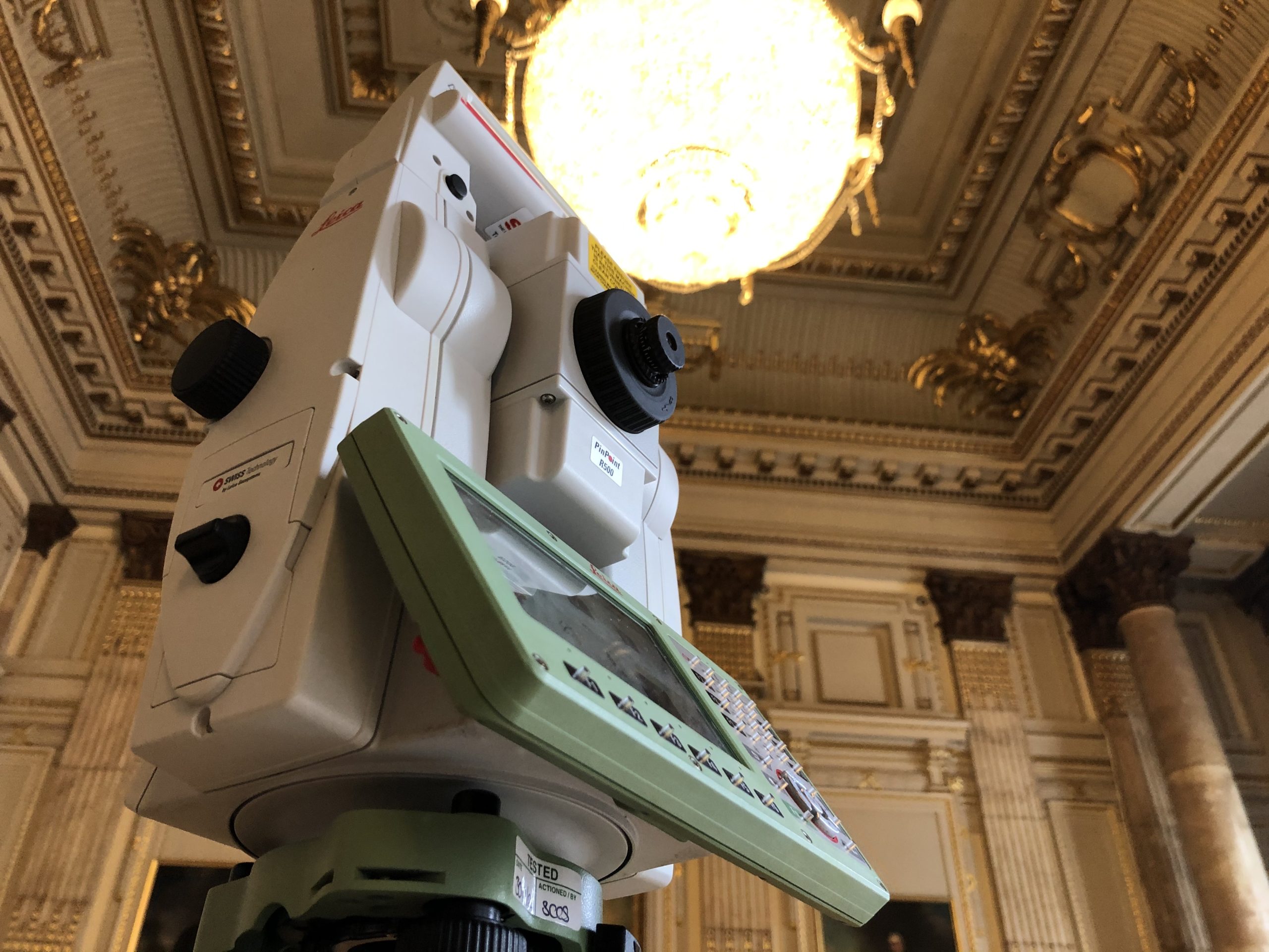
After a lot of research and planning laser scanning with a Leica p40 was decided as the best option to monitor the ceilings, the point cloud data contains millions of 3d data enabling multi-directional movement, this would be perfect as some of the ceilings were curved. The p40 has survey grade control capabilities, builtin compensator, low noise and high resolution.
A control scheme was established using a 1 second Leica TS16 total station and precise traverse set. This consisted of surveying a mix of permanent targets on the walls and in some cases ground stations. This worked extremely well as a lot of rooms were heavily carpeted which meant floor stations weren’t possible.
Each room was scanned using the Leica P40 scan station with multiple setups to ensure coverage of the ceilings. Phase 1 was carried out during August 2021 and the process was repeated for Phase 2 in July 2022. All scan targets were in place for Phase 2.
Phase 1 site images…


PROCESSING:
The control of floor stations and targets were processed using n4ce least squares survey software, generally errors were less than 1mm.
The laser scan data was imported into Leica Cyclone and registered using floor stations, targets and cloud to cloud processes, this ensured accuracy and errors were kept below 2mm. This process was repeated in phase 2 again with similar results.
COMPARING DATASETS:
Once 3d point cloud data was processed, several methods were used to compare the two phases. Leica 3DR was used to quickly compare any deviation, luckily none of the rooms appeared to show any significant deviation, the only room to show any movement was the main stairwell were restoration work had been undertaken. As well as using Leica 3DR, Autocad was also used to compare each rooms ceiling, this was very useful to be able to easily create thin sections in different locations and see any deviations, this was also a visual check on the scan data.
Cloud Compare was also tried out but this struggled with the number of 3d points and was not used.
Phase 1 & Phase 2 comparison data…


Below is a video taken on site by Leica explaining the project.
Thanks to Phil Marsh of Leica Geosystems and an even bigger thanks to Chris Gilks of Leica who helped with the scanning on the first phase of the project and processing on both stages, their support has been invaluable.
More information here on laser scanning…
If you require any further information or have a project in mind, please do not hesitate to get in touch…