Case study – Measured Building Survey of a Church
Wiltshire Church
BRIEF
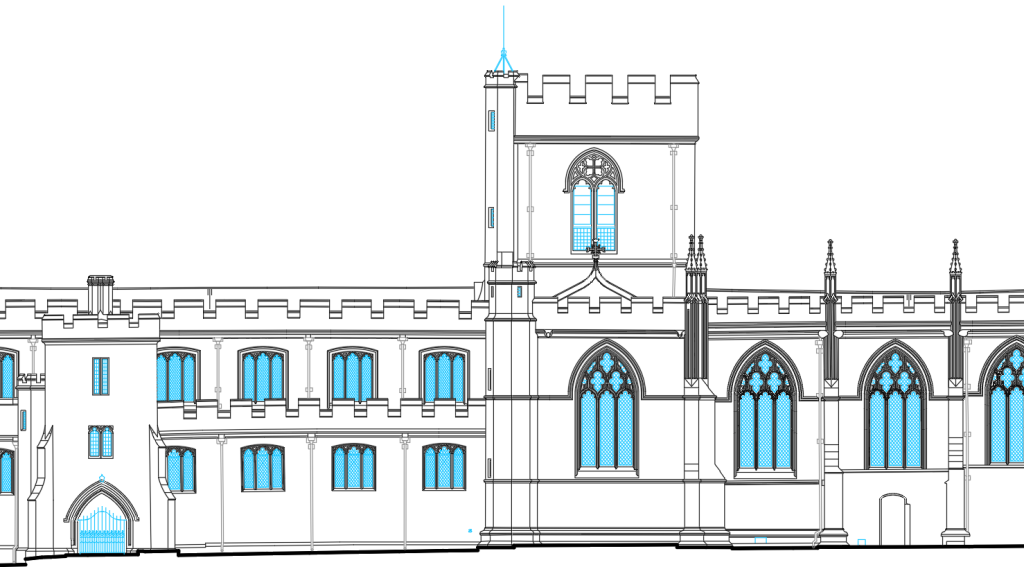
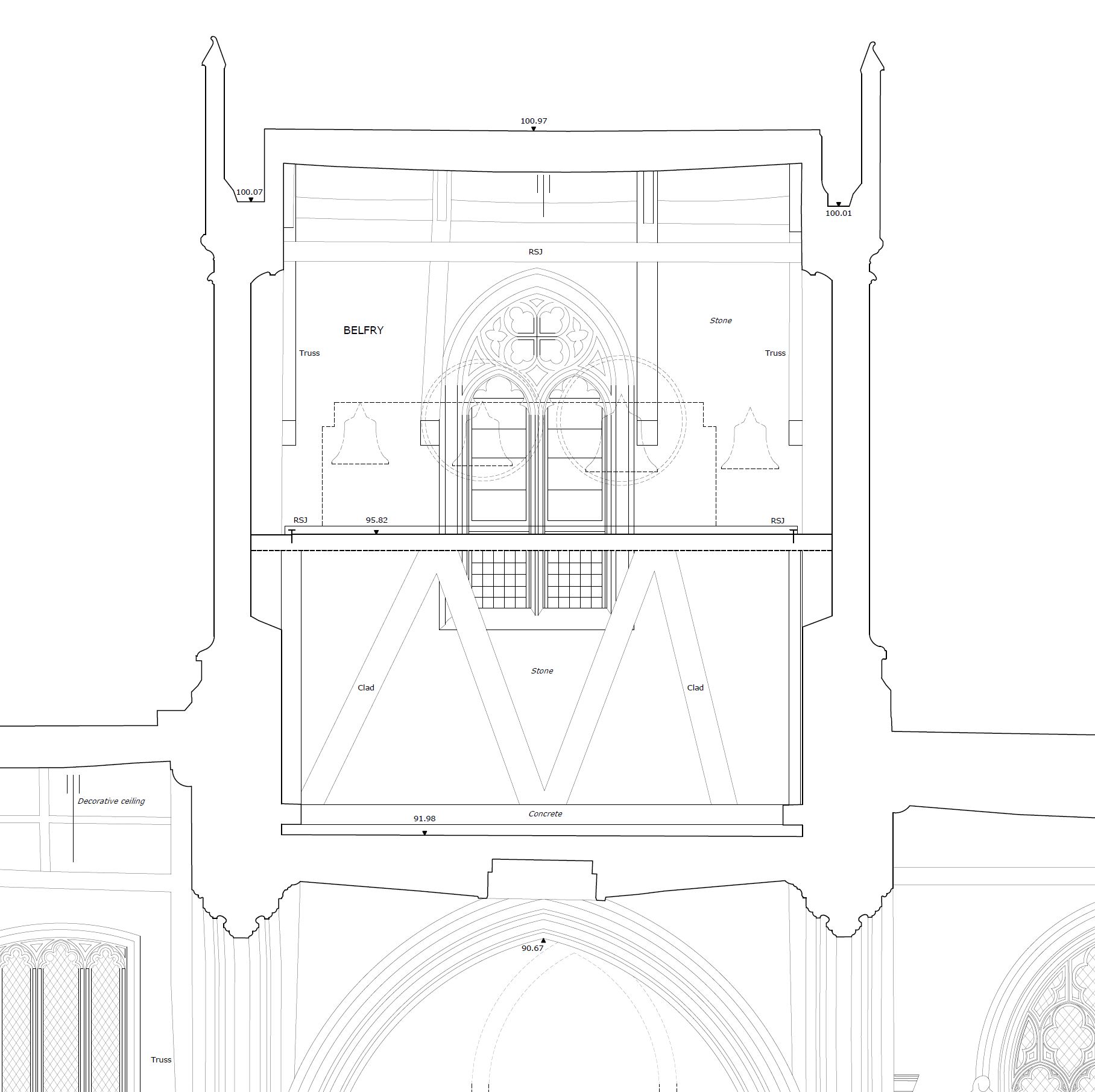
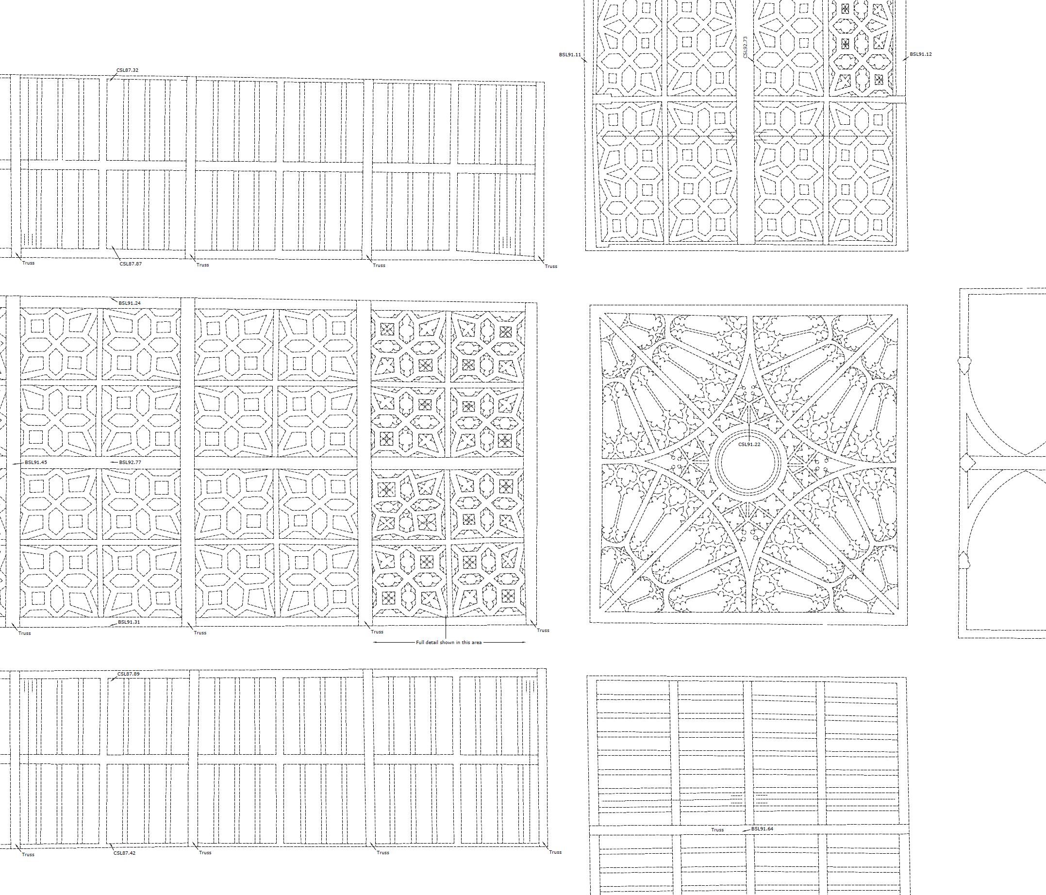
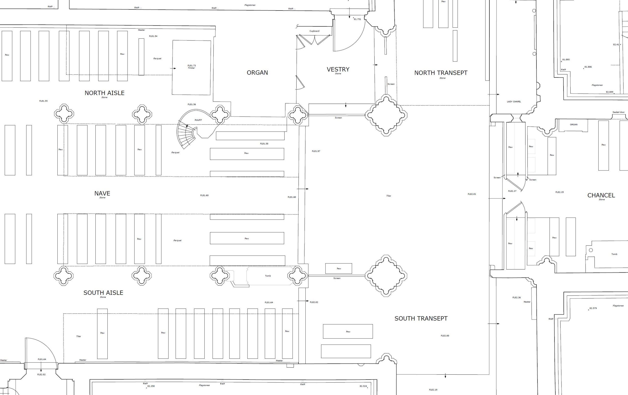
We were asked to carry out a fully detailed measured survey of this lovely church in the heart of Wiltshire. This consisted of floor plans, roof plans, tower plans, ceiling plans, external elevations and sectional elevations.
METHODOLOGY
A full tech survey operation was mounted with laser scanning and drone photogrammetry alongside total station control and infill laser disto dimensions.
This was a perfect project for the Leica rtc360 laser scanner, it’s lightweight but very powerful, perfect for capture of detailing but light enough to get into the belfry and up on the roof.
Our in-house UAV/drone and Canon DSLR was used to capture high resolution images of the roofs and externals, the 3d model built from this data was extremely useful for filling in the missing bits of the scan but also to help with the detailing, laser scanning is great but the detailing can’t yet match the power of photogrammetry.
Fully coordinated control targets were placed in numerous locations throughout the building and these were coordinated with a high accuracy total station, these targets were also used for the photogrammetry. Check points were also taken with the instrument.
PROCESSING
The survey data was processed using n4ce and the scan data with Leica Register360, errors were minimal.
RESULTS
Below are a few examples of the 2d drawings produced..
3d mesh
Below is the 3d mesh created by photogrammetry using photography and survey control points, this mesh has been reduced to be useable via the online 3d platform sketchfab.
If you require any further information or have a project in mind, please do not hesitate to get in touch…