Case study – Greenwich Royal Parks Bandstand
Greenwich Park
BRIEF
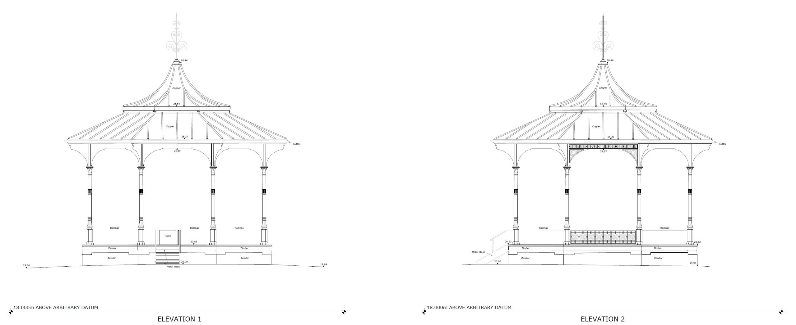
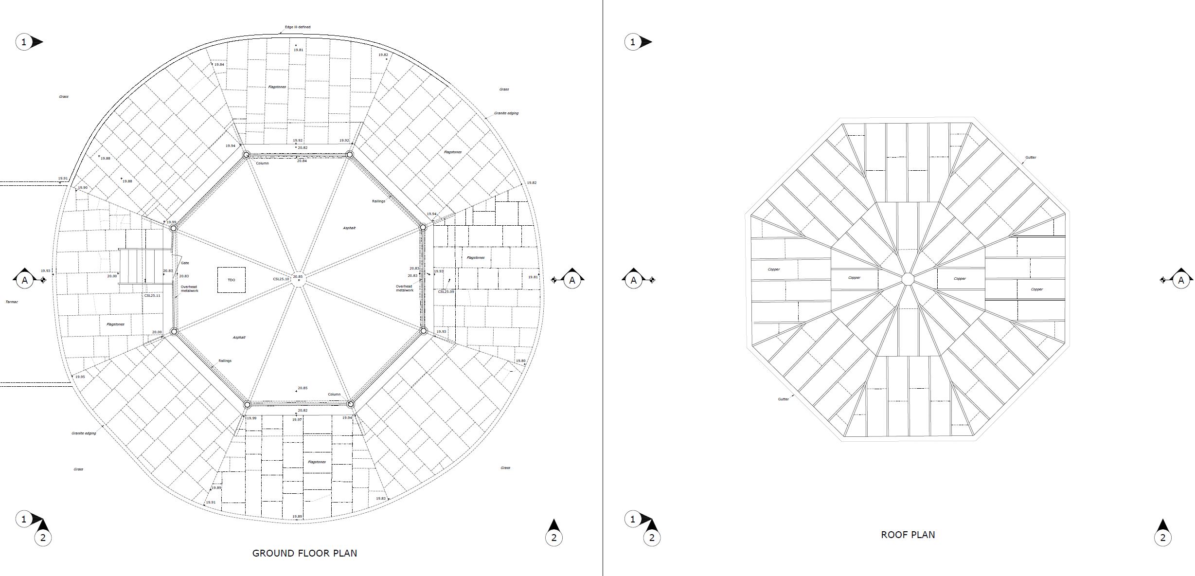
Fully detailed measured survey of this historic bandstand located in Greenwich Park, London. This consisted of a floor plan, roof plan, detailed elevations and a section. The survey information was supplied to Howat O’Farrell Architects.
METHODOLOGY
A full tech survey operation was enabled with laser scanning and 3d photogrammetry with survey control measured with a Leica total station.
This was a perfect project for the Leica rtc360 laser scanner, it’s lightweight but very powerful, perfect for capturing a high level of detail.
Our in-house UAV/drone and Canon DSLR was used to capture high resolution images of the roofs and around the bandstand at ground level.
Fully coordinated control targets were placed in numerous locations inside and on the outside of the bandstand, these were coordinated with a high accuracy total station, these targets were also used for the photogrammetry. Check points were also taken with the instrument.
PROCESSING
The survey data was processed using n4ce and the scan data with Leica Register360, errors were minimal. Ortho rectified imagery was created from the 3d mesh and this very useful for the detailed elevations.
RESULTS
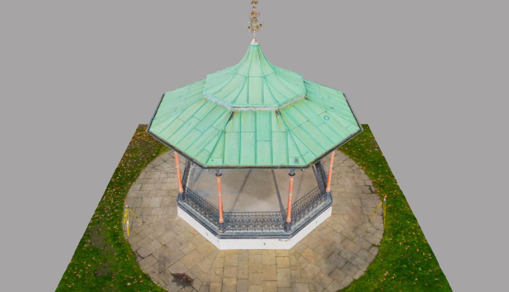
2D drawings were produced and these are shown below, a 3d mesh was also created using a combination of the laser scan data and photogrammetry, this was very impressive even on the low resolution model uploaded to sketchfab.
3d mesh
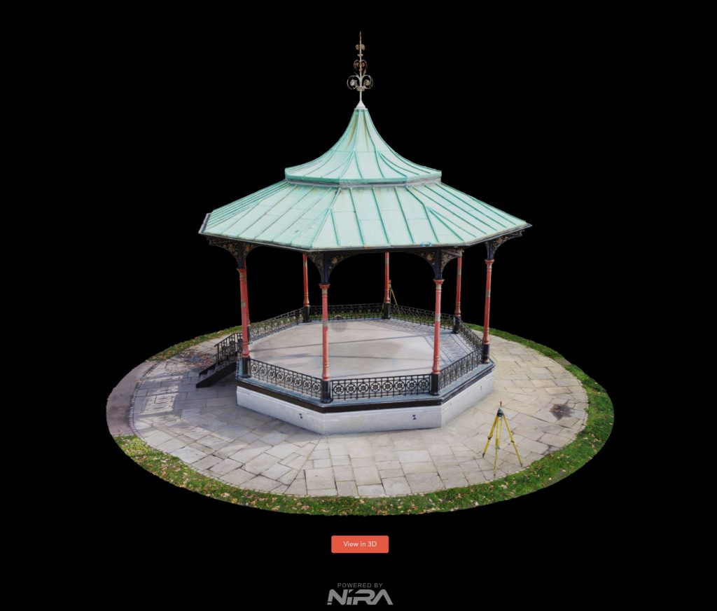
Below is the 3d mesh created by photogrammetry using photography and survey control points, this mesh has been reduced to be useable via the online 3d platform sketchfab.
Alternatively you can view this on the nira.app for more detail, click on the image below to view…
If you require any further information or have a project in mind, please do not hesitate to get in touch…